 Loading... Please wait...
Set 06 - Maryland/Northern Virginia Guide Book and Maps
- Home
- ATC Guide & Map Sets
- Set 06 - Maryland/Northern Virginia Guide Book and Maps
Set 06 - Maryland/Northern Virginia Guide Book and Maps
Product Description
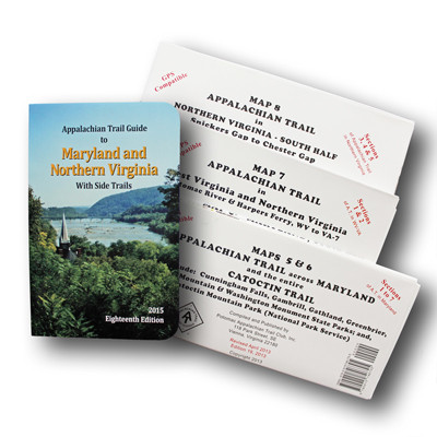
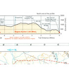
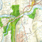
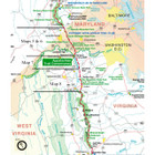
The Maryland and Northern Virginia edition covers 95 miles from Pen Mar on the Pennsylvania state line through Maryland, the Eastern Panhandle of West Virginia, and northern Virginia to the entrance of Shenandoah National Park in one planning guide and three maps. The pocket-sized planning guide contains background and interpretive information, points of interest, general advice, shelters, water sources, and road crossings. The format allows you to see where you are whether southbound or northbound. Each map is focused on the Appalachian Trail and overlaps with the neighboring maps. The surrounding area, out to about three miles, and additional side trails are also included. An easy-to-use elevation profile shows ups and downs and the distance to the next campsite or shelter, side trails, and water sources. For added interest, maps indicate federal or state lands, road crossings, waterfalls, and scenic areas. Maps are both water- and tear-resistant.
- Maps 5 & 6: Appalachian Trail across Maryland and the entire Catoctin Trail. Maps include: Cunningham Falls, Gambrill, Gathland, Greenbrier, South Mountain & Washington Mountain State Parks; and, Catoctin Mountain Park (National Park Service).
Published by Potomac Appalachian Trail Club: 1:63,360-scale, 100 feet contour interval topographic maps. GPS compatible. Revised 2017. - Map 7: Appalachian Trail in West Virginia and Northern Virginia; Potomac River & Harpers Ferry, WV to VA-7.
Published by Potomac Appalachian Trail Club: 1:50,000-scale, 100 feet contour interval topographic maps. GPS compatible. Revised 2018. - Map 8: Appalachian Trail in Northern Virginia – South Half; Snickers Gap to Chester Gap.
Published by Potomac Appalachian Trail Club: 1:63,360-scale, 100 feet contour interval topographic maps. GPS compatible. Revised 2017.
The official Appalachian Trail maps for Maryland and northern Virginia are also available for sale individually. See listing above for item number in ().
Published by the Potomac Appalachian Trail Club. Eighteenth Edition, 2015.
Find Similar Products by Category
Product Reviews
-
Looking forward to using these maps

Gadget (Submitted on Feb 8th 2021)
I'm writing this review before using these maps because, as section hikers, we haven't made it this far north on the AT yet. However, we've been using Nat Geo and other AT maps and books so far and this group of Appalachian Trail Guides looks to provide superior trail information compared to those paper maps/books (except Doris Gove's book Exploring the AT (GA, NC, TN) which is outstanding.
-
great map and guide set for planning and nevigating

Unknown (Submitted on Jul 4th 2020)
I used these maps to plan and navigate a trek and the readability and ease of use are wonderful.
-
Buy this for tips on successful AT hiking

Unknown (Submitted on Jun 29th 2020)
Regardless if you are a day hiker or not, the Maryland/Virginia book is jammed packed with helpful information (must have items, how to read the AT, etc).
There are a plethora of side trails in this section, that most people are unaware of that they exist. This book gives you detailed information for each of those side adventures.
The only possible downside to the book is the fact that there is a lot of repetition. This can be a good thing as the point is definitely made clear.
-
Great maps

Unknown (Submitted on Jul 22nd 2019)
Love these maps to help hike the trail!
-
great maps

Unknown (Submitted on Apr 16th 2018)
Excellent maps. cannot wait to get on the trail

