 Loading... Please wait...
Set 07 - Shenandoah National Park Guide Book and Maps
- Home
- ATC Guide & Map Sets
- Set 07 - Shenandoah National Park Guide Book and Maps
Set 07 - Shenandoah National Park Guide Book and Maps
Product Description
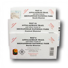
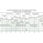
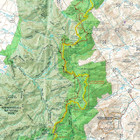
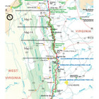
The Shenandoah National Park edition covers 107.8 miles of the Appalachian Trail through the park and highly detailed descriptions of almost 400 miles of increasingly popular side trails, from near Front Royal, Virginia, to near Waynesboro, Virginia, in one guide and three maps. The pocket-sized planning guide contains background and interpretive information, points of interest, general advice, shelters, water sources, and road crossings. The format allows you to see where you are whether southbound or northbound. Each map is focused on the Appalachian Trail and overlaps with the neighboring maps. The surrounding area, out to about three miles, and additional side trails are also included. An easy-to-use elevation profile shows ups and downs and the distance to the next campsite or shelter, side trails, and water sources. For added interest, maps indicate federal or state lands, road crossings, waterfalls, and scenic areas. Maps are both water- and tear-resistant.
- Map 9: Appalachian Trail and other trails in Shenandoah National Park North District
Published by Potomac Appalachian Trail Club: 1:62,500-scale, 100 feet contour interval topographic maps. GPS compatible. Revised 2015. - Map 10: Appalachian Trail and other trails in Shenandoah National Park Central District
Published by Potomac Appalachian Trail Club: 1:62,200-scale, 100 feet contour interval topographic maps. GPS compatible. Revised 2013. - Map 11: Appalachian Trail and other trails in Shenandoah National Park South District
Published by Potomac Appalachian Trail Club: 1:63,360-scale, 100 feet contour interval topographic maps. GPS compatible. Revised 2014.
The official Appalachian Trail maps for Shenandoah National Park are available for sale individually. See listing above for item number in ().
Published by the Potomac Appalachian Trail Club. Fifteenth Edition, 2016.
Find Similar Products by Category
Product Reviews
-
Great planning tool

Rich L (Submitted on Jun 14th 2021)
I am planning to hike the 108 miles of the AT thru Shenandoah State park . These maps and guide book are great tools for planning my hike. I recommend it for any hiking the
AT or any trail in Shenandoah State park
-
A ton of information

Randy Johnson (Submitted on Oct 4th 2020)
This guidebook and map set has a ton of great information. While it is going to take some time to work through it all, it is also very accessible - I was able to easily find the sections relevant to my upcoming trip. What a great resource!
-
Great Maps

lynn mcconnell (Submitted on Jun 8th 2020)
I just received these maps and guides. I am trying to read all of the guide which is packed with info.
The maps have tons of info also and I'm sure they will be a life saver when planning the specifics of our section hike.
-
Excellent map pack. Great service also!

Mark (Submitted on Jun 20th 2019)
This is an excellent map pack - everything I need including a concise and easy to navigate guide book.
Excellent quality - and arrived with me here in Northern Ireland much more quickly than expected. Certainly an excellent level of service!
-
Shenandoah NP Maps

Lee (Submitted on Mar 10th 2019)
I have enjoyed looking and studying the map and the SNP Book. I have found these very exciting and informative and detailed to the point that I expect from this type of information. I am looking forward to my hikes and verifying the information on the maps and in the guide book. For this review I have given this a 4, I am sure after my hikes the review will be worthy of a 5.
-
Useful quality maps

Unknown (Submitted on May 8th 2018)
The AT maps are quality as expected from the PATC, side trails and PATC cabin locations help w/ planning hikes / stays. The book gives a nice preview of what to expect as you hike the AT through SNP.
-
Superior

Catie (Submitted on Mar 6th 2018)
Waterproof maps and detailed guide book. Excellent quality.


